Historical_DEM_and_Modern_DEM_Comparison
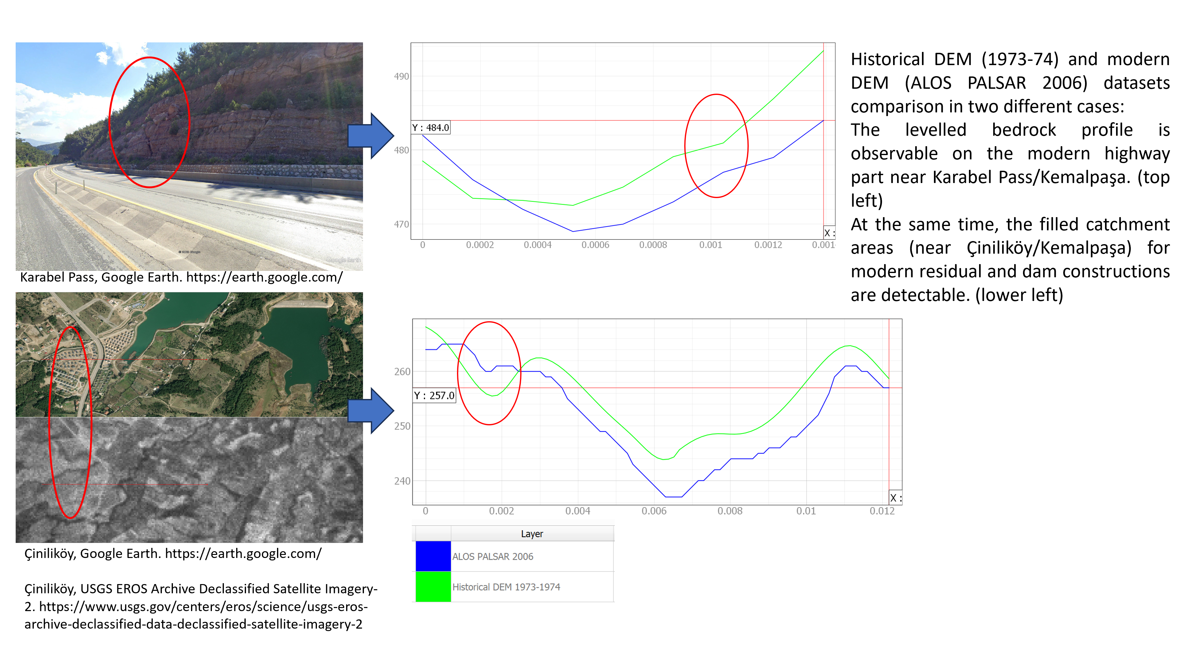
Historical DEM (1973-74) and modern DEM (ALOS PALSAR 2006) datasets comparison in two different cases: The leveled bedrock profile is observable on the modern highway part near Karabel Pass/Kemalpaşa. At the same time, the filled catchment areas (near Çiniliköy/Kemalpaşa) for modern residual and dam constructions are detectable.
Cite this as
Onur Özbalaban (0000-0003-0013-8045) [05q9y3f51]; Müjde Peker (0000-0003-3776-4023) [03a5qrr21] (2024). Historical_DEM_and_Modern_DEM_Comparison (from Everchanging Road Networks Through the Ages on the Mount Nif and its Surroundings. Supplementary Figures) [Data set resource]. DAI.
https://repo.dainst.org/ko_KR/dataset/figures-of-the-everchanging-road-networks-through-the-ages-on-the-mount-nif-and-its-surroundings/resource/e99f0a18-e04e-4f41-b2c4-2b5cfb808f06
Retrieved: 14:52 23 Sep 2025 (UTC)
추가 정보
| 필드 | 값 |
|---|---|
| 마지막으로 업데이트된 데이터 | 2024년 6월 9일 |
| 마지막으로 업데이트된 메타데이터 | 2024년 6월 9일 |
| 생성됨 | 알 수 없는 |
| 포맷 | PNG |
| 라이센스 | Creative Commons Attribution-NonCommercial 4.0 |
| Media type | image/png |
| Size | 3,267,744 |
| Datastore active | False |
| Has views | True |
| Id | e99f0a18-e04e-4f41-b2c4-2b5cfb808f06 |
| Package id | 26b113fa-9281-400d-a717-a187516c9166 |
| Position | 1 |
| State | active |
| Url type | upload |
| 생성됨 | 1년 전 |